
I bought myself an electric trike. I named it Trixie. Because, why not!
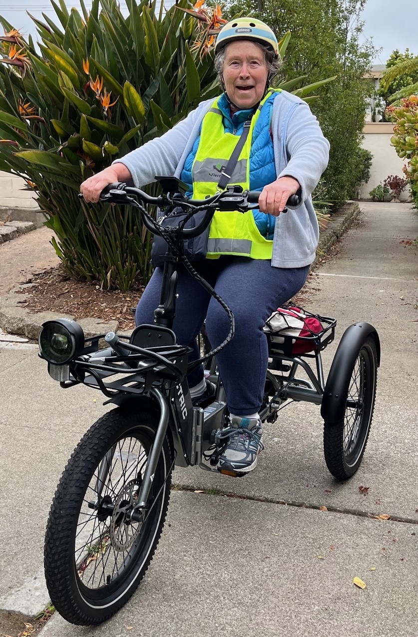
For over a decade, I had a perfectly good bike, which I enjoyed riding around town. But in the past few years I’ve had both knees replaced. They work better than they did, but—oh, well, I’m not getting any younger.
So, the aches, pains and twinges have increased. I no longer felt stable and secure on the two-wheeler. At my age, I told myself, all I need to do is fall off this damn bike. Then where would I be? In a cast? In rehab?
I figure three wheels are more stable than two. Trixie has pedal assist, which means if I’m laboring up a hill, I can kick up the oomph to better get where I’m going. And it has cruise control. Who knew? There are so many short trips that I can take without using my car—the library, the farmers’ market, my Italian language group at the senior center.
Once I got the e-trike all put together and all the doodads installed, I charged it up and took it out to my condo complex’s driveway for a test ride. News flash. Riding a trike feels different from riding a bike. There was a bit of a learning curve.
I’m out on the street now, in my striped helmet, pedaling along and enjoying the beautiful spring weather, coming home from the farmers’ market with lots of fresh produce in my trike basket.
And I’m singing “Born to the Wild.” If you are the same vintage as I am, surely you remember that rock song from 1968, with the band Steppenwolf, telling us to get our motors running and head out for the highway, in search of adventure. Yeah, you remember. It was in the movie Easy Rider.
What, you ask, does this have to do with writing? It could mean going off in a different direction when the situation warrants it. The bike wasn’t working for me, so I got the e-trike, and now I’m out there pedaling in the sunshine, getting exercise.
Sometimes things aren’t working for the work-in-progress. That means I need to change direction. That could mean taking a different approach with my plot, characters and/or setting.
There’s a quote that’s attributed to Raymond Chandler: “In writing a novel, when in doubt, have two guys come through the door with guns.” You can interpret that any way you want, but for me, it means, change it. Do something different. That may very well unblock your block or add nuance to a character.
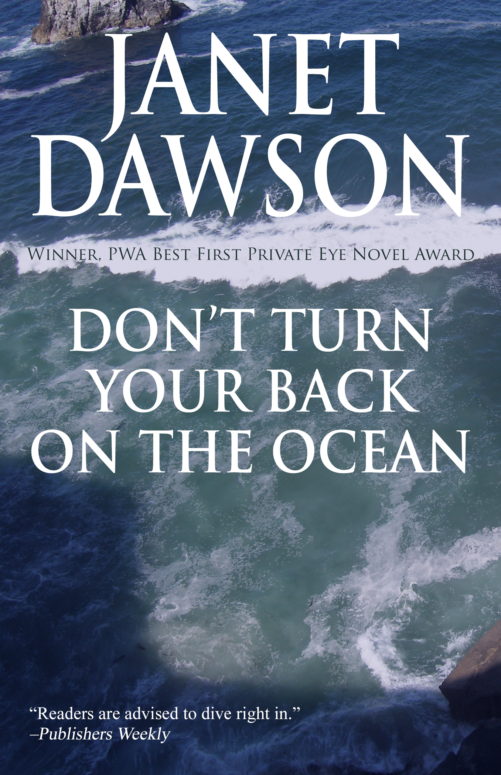
In Don’t Turn Your Back on the Ocean, my private eye Jeri Howard visits her mother and various relatives in Monterey. Her cousin Bobby’s girlfriend has vanished, and people think he had something to do with it. While I was writing the first draft, things got bogged down. My solution wasn’t two guys with guns. It was local law enforcement arresting Bobby on a murder charge. That certainly increased the tension, and the pressure on Jeri to investigate.
In Witness to Evil, Jeri is down in Bakersfield looking for a missing person. There’s been a murder, but are the two related? I reached a point where I wasn’t sure what happened next. All I knew was at some point Jeri followed a lead to Los Angeles. I changed things up by changing the setting, putting Jeri on the freeway to the City of Angels, where she poked around in various places and found out all sorts of information. I wrote seven chapters in six days.
Whether it’s two guys with guns or pedaling down the street on an e-trike, making those changes helps me up the ante in my writing—and in life.
I really need a flag that says “Triker Mama.”


You must be logged in to post a comment.